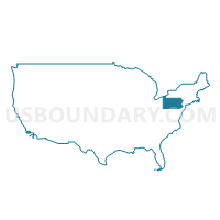
Westmoreland County (Northwest)--Murrysville Municipality & New Kensington City PUMA, Pennsylvania
About
Outline
--Murrysville+Municipality+%26+New+Kensington+City+PUMA%2c+Pennsylvania_A280.png)
Summary
| Unique Area Identifier | 193909 |
| Name | Westmoreland County (Northwest)--Murrysville Municipality & New Kensington City PUMA |
| State | Pennsylvania |
| Area (square miles) | 169.98 |
| Land Area (square miles) | 167.54 |
| Water Area (square miles) | 2.45 |
| % of Land Area | 98.56 |
| % of Water Area | 1.44 |
| Latitude of the Internal Point | 40.49979160 |
| Longtitude of the Internal Point | -79.64612040 |
Maps
--Murrysville+Municipality+%26+New+Kensington+City+PUMA in Pennsylvania.png)
Westmoreland County (Northwest)--Murrysville Municipality & New Kensington City PUMA in Pennsylvania
Download
Graphs
Select a template below for downloading or customizing gragh for Westmoreland County (Northwest)--Murrysville Municipality & New Kensington City PUMA, Pennsylvania
--Murrysville+Municipality+%26+New+Kensington+City+PUMA%2c+Pennsylvania_T0.png)
--Murrysville+Municipality+%26+New+Kensington+City+PUMA%2c+Pennsylvania_T1.png)
--Murrysville+Municipality+%26+New+Kensington+City+PUMA%2c+Pennsylvania_T2.png)
--Murrysville+Municipality+%26+New+Kensington+City+PUMA%2c+Pennsylvania_T3.png)
--Murrysville+Municipality+%26+New+Kensington+City+PUMA%2c+Pennsylvania_T4.png)
--Murrysville+Municipality+%26+New+Kensington+City+PUMA%2c+Pennsylvania_T5.png)
--Murrysville+Municipality+%26+New+Kensington+City+PUMA%2c+Pennsylvania_T6.png)
--Murrysville+Municipality+%26+New+Kensington+City+PUMA%2c+Pennsylvania_T7.png)
Neighbors
Neighoring Public Use Microdata Area (by Name) Neighboring Public Use Microdata Area on the Map
- Allegheny County (East)--Monroeville Municipality, Plum & Wilkinsburg Boroughs PUMA, PA
- Allegheny County (North)--Franklin Park Borough & Allison Park PUMA, PA
- Allegheny County (Southeast)--West Mifflin Borough, McKeesport City & Munhall Borough PUMA, PA
- Indiana & Armstrong Counties PUMA, PA
- Westmoreland County (East) PUMA, PA
- Westmoreland County (Southwest)--Greensburg City PUMA, PA
Top 10 Neighboring County (by Population) Neighboring County on the Map
Top 10 Neighboring County Subdivision (by Population) Neighboring County Subdivision on the Map
- Hempfield township, Westmoreland County, PA (43,241)
- North Huntingdon township, Westmoreland County, PA (30,609)
- Monroeville municipality, Allegheny County, PA (28,386)
- Plum borough, Allegheny County, PA (27,126)
- Murrysville municipality, Westmoreland County, PA (20,079)
- Penn township, Westmoreland County, PA (20,005)
- New Kensington city, Westmoreland County, PA (13,116)
- Lower Burrell city, Westmoreland County, PA (11,761)
- Harrison township, Allegheny County, PA (10,461)
- North Versailles township, Allegheny County, PA (10,229)
Top 10 Neighboring Place (by Population) Neighboring Place on the Map
- Monroeville municipality, PA (28,386)
- Plum borough, PA (27,126)
- Murrysville municipality, PA (20,079)
- New Kensington city, PA (13,116)
- Lower Burrell city, PA (11,761)
- Jeannette city, PA (9,654)
- Vandergrift borough, PA (5,205)
- Arnold city, PA (5,157)
- Tarentum borough, PA (4,530)
- Level Green CDP, PA (4,020)
Top 10 Neighboring Unified School District (by Population) Neighboring Unified School District on the Map
- Hempfield Area School District, PA (50,268)
- Norwin School District, PA (35,529)
- Gateway School District, PA (31,680)
- Kiski Area School District, PA (28,857)
- Plum Borough School District, PA (27,126)
- Greensburg Salem School District, PA (26,086)
- Penn-Trafford School District, PA (26,083)
- Franklin Regional School District, PA (22,947)
- Highlands School District, PA (20,627)
- New Kensington-Arnold School District, PA (18,273)
Top 10 Neighboring State Legislative District Lower Chamber (by Population) Neighboring State Legislative District Lower Chamber on the Map
- State House District 55, PA (60,812)
- State House District 56, PA (60,727)
- State House District 54, PA (60,370)
- State House District 58, PA (59,656)
- State House District 57, PA (59,613)
- State House District 33, PA (59,492)
- State House District 25, PA (59,461)
- State House District 60, PA (58,162)
- State House District 32, PA (56,991)
Top 10 Neighboring State Legislative District Upper Chamber (by Population) Neighboring State Legislative District Upper Chamber on the Map
- State Senate District 39, PA (238,771)
- State Senate District 41, PA (236,058)
- State Senate District 45, PA (220,981)
- State Senate District 38, PA (213,989)
Top 10 Neighboring 111th Congressional District (by Population) Neighboring 111th Congressional District on the Map
- Congressional District 18, PA (653,385)
- Congressional District 4, PA (647,418)
- Congressional District 12, PA (612,384)
Top 10 Neighboring Census Tract (by Population) Neighboring Census Tract on the Map
- Census Tract 8020.02, Westmoreland County, PA (7,611)
- Census Tract 5261.01, Allegheny County, PA (6,902)
- Census Tract 8023.04, Westmoreland County, PA (6,623)
- Census Tract 8019, Westmoreland County, PA (6,623)
- Census Tract 8018, Westmoreland County, PA (6,550)
- Census Tract 8023.01, Westmoreland County, PA (6,075)
- Census Tract 8021.02, Westmoreland County, PA (6,071)
- Census Tract 9512, Armstrong County, PA (5,991)
- Census Tract 8038, Westmoreland County, PA (5,838)
- Census Tract 5644, Allegheny County, PA (5,620)
Top 10 Neighboring 5-Digit ZIP Code Tabulation Area (by Population) Neighboring 5-Digit ZIP Code Tabulation Area on the Map
- 15601, PA (59,483)
- 15642, PA (45,286)
- 15068, PA (38,785)
- 15146, PA (28,323)
- 15239, PA (21,024)
- 15644, PA (18,836)
- 15613, PA (13,933)
- 15668, PA (13,139)
- 15065, PA (11,588)
- 15656, PA (10,298)


--Murrysville+Municipality+%26+New+Kensington+City+PUMA%2c+Pennsylvania.png)